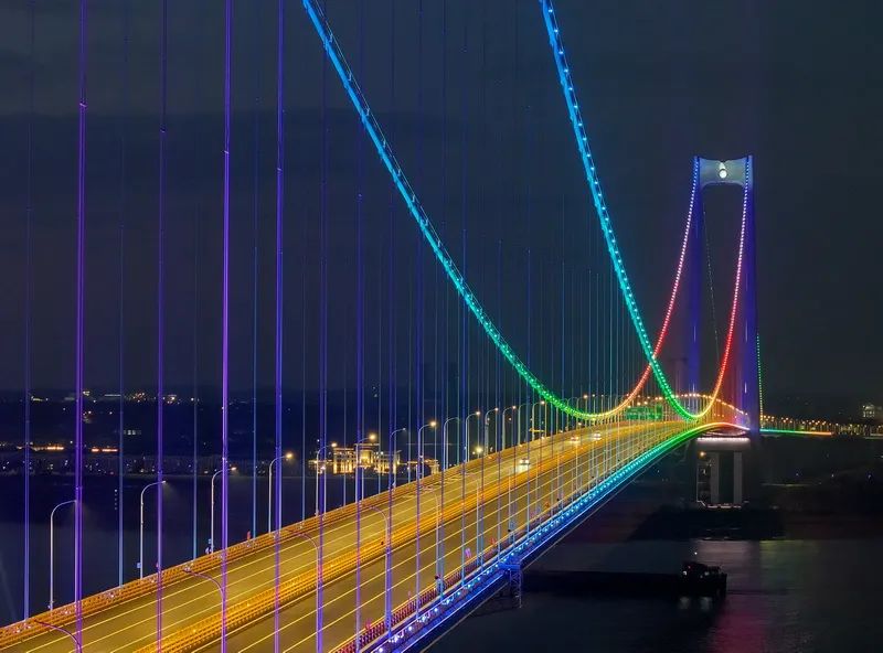
In the evening of December 18th, Longtan Yangtze River Bridge was lighted for trial lighting. At present, Longtan Yangtze River Bridge is orderly promoting the construction of ancillary structural engineering. (Photo from Nanjing Daily/Zijinshan News reporter Xu Qi)
As a key transportation project in Jiangsu Province
--Longtan Yangtze River Bridge expected to open next month
whereupon
6 minutes from Nanjing Longtan to Yangzhou Yizheng
Half an hour to the main city of Yangzhou

Longtan Yangtze River Bridge is an important part of the Yizheng-Lukou Airport Expressway in the Nanjing Metropolitan Area Expressway Ring Road, which is included in the provincial expressway network.
After the completion of the bridge, will be handed over to Jiangsu Transportation Holdings Limited operation, bridge vehicles will be based on different types of passenger and freight vehicles, the implementation of tolls, previously online there has been a Longtan River Crossing toll policy questionnaire, in accordance with the relevant requirements of the toll policy.Proposed this fee for: a class of passenger cars 40 yuan / trip, a class of trucks 45 yuan / trip, other car weight reference implementation.Specific standards of the relevant departments will be released to the public on the basis of full research and demonstration.


It is understood that the Longtan Yangtze River Bridge according to two-way six-lane highway standard construction, design speed of 100 kilometers per hour, the main bridge span 1560 meters "a span across the river", for the single-span suspension steel box girder suspension bridge. South tower height of 237.5 meters, the north tower height of 235.5 meters, the bridge tower using the "Double Dragon Pearl" landscape modeling, known as "the most beautiful Yangtze River Bridge.
After the completion of the bridge, it will be of great significance to promote the integrated development of Yangzi River City Cluster and Ningzhen-Yangzhou, accelerate the construction of comprehensive three-dimensional transportation corridor, and optimize the layout of river crossings.